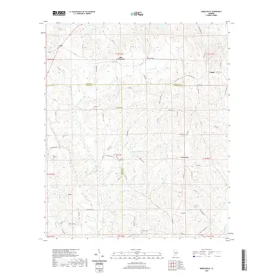
2020 Map of Danielsville
USGS Topo · Published 2020About this map
Danielsville sits at the center of this rural South Alabama landscape, where the borders of Butler, Lowndes, and Crenshaw counties converge. The region is defined by a dense network of creek branches and ponds, including Stringer Mill Cr, Moseley Mill Cr, and Ryals Mill Cr, suggesting a long history of water-powered industry now quieted. Small rural settlements like Logan, Panola, and Ellis Crossroads anchor the crossroads, while the terrain to the south transitions into the low-lying Pigeon Creek Swamp. Genealogists will find significant value in the distribution of family and community burial sites, from Oak Bowery Cem in the west to the centrally located King Cem and Spring Creek Cem. The surveyor's work captures a pastoral area where old trails like Old Meriwether Trl and Meriwether Trl trace the higher ground between the numerous drainages of Little Patsaliga Cr.
Find a feature on this map
91 named features on this map. Tap any name to fly to it.
Don’t see what you’re looking for? This feature index may not catch every label — zoom into the map to look around manually.
Map Details
Editions of this 2020 Danielsville Map
This is the sole edition of this map. No revisions or reprints were ever made.
Other maps of this area

1953 · Montgomery
USGS Topo · 1:250,000

1953 · Andalusia
USGS Topo · 1:250,000

1956 · Montgomery
USGS Topo · 1:250,000

1957 · Montgomery
USGS Topo · 1:250,000

1957 · Andalusia
USGS Topo · 1:250,000

1957 · Letohatchee
USGS Topo · 1:62,500

1971 · Fullers Crossroads
USGS Topo · 1:24,000

1971 · Fort Deposit
USGS Topo · 1:24,000

1971 · Honoraville
USGS Topo · 1:24,000

1971 · Greenville East
USGS Topo · 1:24,000