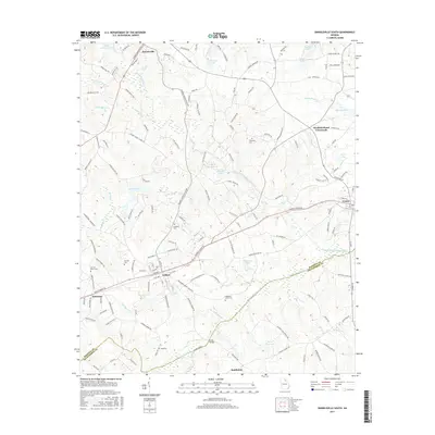
2017 Map of Danielsville South
USGS Topo · Published 2017About this map
Danielsville anchors the northern reaches of this Madison County landscape, where the South Fork Broad River and its numerous tributaries like Scull Shoal Cr carve through the terrain. The map details a transition from the structured street grids of Colbert and Comer to the more dispersed agricultural settlements of Smithonia and Patterson. For local historians and genealogists, the density of family and community burial grounds is significant, including the Sorrow-Mann Cem, Kincaid Cem, and Waggoner Grove Cem. Water management is a defining characteristic of the area, evidenced by the numerous named impoundments such as O'Kelley Lake, Sasnett Lake, and Baptist Association Lake that dot the countryside between the larger river forks.
Find a feature on this map
157 named features on this map. Tap any name to fly to it.
Don’t see what you’re looking for? This feature index may not catch every label — zoom into the map to look around manually.
Map Details
Editions of this 2017 Danielsville South Map
This is the sole edition of this map. No revisions or reprints were ever made.
Other maps of this area

1891 · Carnesville
USGS Topo · 1:125,000

1953 · Athens
USGS Topo · 1:250,000

1954 · Greenville
USGS Topo · 1:250,000

1958 · Greenville
USGS Topo · 1:250,000

1958 · Athens
USGS Topo · 1:250,000

1958 · Danielsville
USGS Topo · 1:62,500

1959 · Athens
USGS Topo · 1:250,000

1963 · Athens
USGS Topo · 1:250,000

1964 · Ila
USGS Topo · 1:24,000

1964 · Hull
USGS Topo · 1:24,000