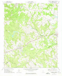
1972 Map of Danielsville South
USGS Topo · Published 1974About this map
Danielsville and Comer anchor this pocket of Northeast Georgia in the early 1970s, where the landscape is defined by the forks of the South Fork Broad River and numerous small-scale agricultural settlements. The Seaboard Coast Line railroad cuts a diagonal path through the terrain, connecting the larger towns like Colbert and Patterson to the wider region. Outside the primary town centers, the map reveals a dense network of local landmarks essential to rural community life, including Meadow Ch, Lystria Ch, and the Hitchcock Cem. Notable industrial and civic features such as the Sewage Disposal plant near Danielsville and the South Madison Middle Sch reflect the infrastructure of the era. The southern portion of the map is marked by Smithonia, while the central area features Gholston Stand Crossroads, indicating how local travel and commerce were organized around these vital junctions.
Find a feature on this map
40 named features on this map. Tap any name to fly to it.
Don’t see what you’re looking for? This feature index may not catch every label — zoom into the map to look around manually.
Map Details
Editions of this 1972 Danielsville South Map
This is the sole edition of this map. No revisions or reprints were ever made.
Other maps of this area

1891 · Carnesville
USGS Topo · 1:125,000

1953 · Athens
USGS Topo · 1:250,000

1954 · Greenville
USGS Topo · 1:250,000

1958 · Greenville
USGS Topo · 1:250,000

1958 · Athens
USGS Topo · 1:250,000

1958 · Danielsville
USGS Topo · 1:62,500

1959 · Athens
USGS Topo · 1:250,000

1963 · Athens
USGS Topo · 1:250,000

1964 · Ila
USGS Topo · 1:24,000

1964 · Hull
USGS Topo · 1:24,000