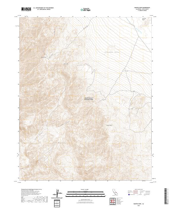
2021 Map of Dantes View
USGS Topo · Published 2021About this map
Death Valley National Park encompasses this dramatic stretch of the Black Mountains and the Amargosa Range, centered on the famous lookout at Dantes View. The terrain is defined by extreme elevation changes, dropping from high ridges into the broad Greenwater Valley and the northern reaches of the Mojave Desert. The map documents high-altitude pathways including the Dantes Peak Trl and Mount Perry Trl, which follow the knife-edge ridges above the valley floor. Deeply carved drainages such as Copper Canyon and Coffin Canyon cut through the western slopes, while Furnace Cr Wash drains the northeastern corner. This survey is a record of the modern infrastructure and trail networks within the park, highlighting the singular access provided by Dantes View Road as it winds toward Coffin Peak.
Find a feature on this map
16 named features on this map. Tap any name to fly to it.
Don’t see what you’re looking for? This feature index may not catch every label — zoom into the map to look around manually.
Map Details
Editions of this 2021 Dantes View Map
This is the sole edition of this map. No revisions or reprints were ever made.
Other maps of this area

1908 · Furnace Creek
USGS Topo · 1:250,000

1910 · Furnace Creek
USGS Topo · 1:250,000

1948 · Death Valley
USGS Topo · 1:250,000

1951 · Funeral Peak
USGS Topo · 1:62,500

1952 · Furnace Creek
USGS Topo · 1:62,500

1952 · Ryan
USGS Topo · 1:62,500

1952 · Bennetts Well
USGS Topo · 1:62,500

1954 · Death Valley
USGS Topo · 1:250,000

1956 · Death Valley
USGS Topo · 1:250,000

1957 · Death Valley
USGS Topo · 1:250,000