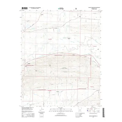
2014 Map of Danville Mountain
USGS Topo · Published 2014About this map
The Petit Jean River meanders across this landscape, creating a complex network of wetlands including Elm Root Slough, Cane Island Slough, and Cape Slough. These waterways define the geography between the northern agricultural flats near Ranger and Alpha and the rising timberlands of the Ouachita National Forest to the south. The city of Danville sits at the western edge of the formidable Danville Mtn, where the terrain transitions sharply from the river valley to higher elevations like Bunker Hill and Peeler Gap. Local transportation and early settlement patterns are visible through rural hubs like Mickles and Lone Pine, while the New Bethel Cem in the southwest provides a specific point of interest for genealogical research near the community of Kingston. The map illustrates the varied topography of Yell County, from the lowland Surrounded Ridges Lake to the heights of Ola Mtn.
Find a feature on this map
73 named features on this map. Tap any name to fly to it.
Don’t see what you’re looking for? This feature index may not catch every label — zoom into the map to look around manually.
Map Details
Editions of this 2014 Danville Mountain Map
This is the sole edition of this map. No revisions or reprints were ever made.
Other maps of this area

1888 · Dardanelle #4
USGS Topo · 1:62,500

1888 · Dardanelle #3
USGS Topo · 1:62,500

1890 · Hot Springs
USGS Topo · 1:125,000

1890 · Dardanelle
USGS Topo · 1:125,000

1894 · Hot Springs
USGS Topo · 1:125,000

1955 · Little Rock
USGS Topo · 1:250,000

1956 · Little Rock
USGS Topo · 1:250,000

1956 · Russellville
USGS Topo · 1:250,000

1960 · Little Rock
USGS Topo · 1:250,000

1964 · Russellville
USGS Topo · 1:250,000