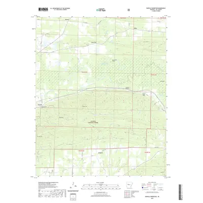
2020 Map of Danville Mountain
USGS Topo · Published 2020About this map
The Petit Jean River meanders across this Yell County landscape, shaping a complex system of bottomlands including Elm Root Slough, Cape Slough, and Cane Island Slough. This fluvial network is contrasted by the rising elevations of Danville Mtn and Bunker Hill, which mark the northern edges of the Ouachita National Forest. The settlement of Danville serves as a primary hub, while smaller communities and localities like Ranger, Alpha, and Kingston are connected by a web of county roads and historic routes such as Peeler Gap Rd. The southern portion of the map is defined by the steep terrain of Peeler Gap, where several small tributaries, including McCargo Br and Porter Cr, drain toward the river basin. Cultural landmarks like New Bethel Cem and the Achmun Creek Bridge provide specific points of reference for local historians studying the rural development of this river-valley region.
Find a feature on this map
60 named features on this map. Tap any name to fly to it.
Don’t see what you’re looking for? This feature index may not catch every label — zoom into the map to look around manually.
Map Details
Editions of this 2020 Danville Mountain Map
This is the sole edition of this map. No revisions or reprints were ever made.
Other maps of this area

1888 · Dardanelle #4
USGS Topo · 1:62,500

1888 · Dardanelle #3
USGS Topo · 1:62,500

1890 · Hot Springs
USGS Topo · 1:125,000

1890 · Dardanelle
USGS Topo · 1:125,000

1894 · Hot Springs
USGS Topo · 1:125,000

1955 · Little Rock
USGS Topo · 1:250,000

1956 · Little Rock
USGS Topo · 1:250,000

1956 · Russellville
USGS Topo · 1:250,000

1960 · Little Rock
USGS Topo · 1:250,000

1964 · Russellville
USGS Topo · 1:250,000