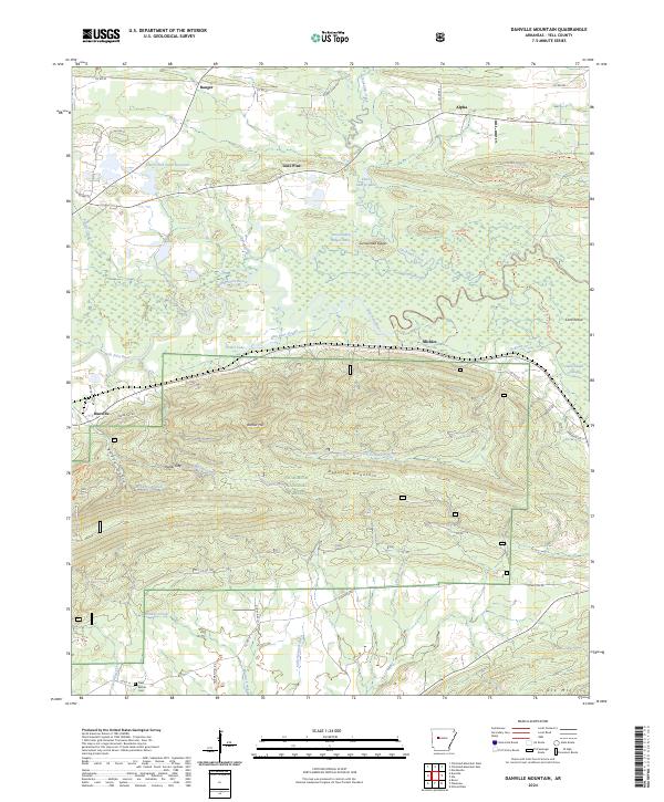
2024 Map of Danville Mountain
USGS Topo · Published 2024About this map
The Petit Jean River meanders across this landscape, defining a valley dominated by the prominent ridge of Danville Mountain. To the north, the terrain transitions into a mosaic of wetlands and small water bodies like Surrounded Ridges Lake, Gape Slough, and Elm Root Slough, reflecting the complex hydrology of the river's floodplain. The town of Danville sits on the western edge, while smaller settlements such as Ranger, Lone Pine, and Alpha are scattered along the northern corridor near Harris Fish Farm Reservoir.
Find a feature on this map
68 named features on this map. Tap any name to fly to it.
Don’t see what you’re looking for? This feature index may not catch every label — zoom into the map to look around manually.
Map Details
Editions of this 2024 Danville Mountain Map
This is the sole edition of this map. No revisions or reprints were ever made.
Other maps of this area

1888 · Dardanelle #4
USGS Topo · 1:62,500

1888 · Dardanelle #3
USGS Topo · 1:62,500

1890 · Hot Springs
USGS Topo · 1:125,000

1890 · Dardanelle
USGS Topo · 1:125,000

1894 · Hot Springs
USGS Topo · 1:125,000

1955 · Little Rock
USGS Topo · 1:250,000

1956 · Little Rock
USGS Topo · 1:250,000

1956 · Russellville
USGS Topo · 1:250,000

1960 · Little Rock
USGS Topo · 1:250,000

1964 · Russellville
USGS Topo · 1:250,000