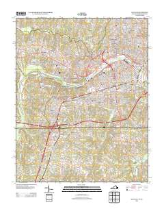
2013 Map of Danville
USGS Topo · Published 2013About this map
The Dan River winds through the heart of this Virginia-North Carolina borderland, serving as the central axis for a landscape defined by dense residential expansion and established neighborhoods. The map illustrates a high concentration of named subdivisions and historical districts such as Schoolfield, Almagro, and Forest Hills, reflecting the suburban development patterns of the early 21st century. Infrastructure is prominent, with multiple crossings like the Main Street Bridge and Union Street Bridge connecting the north and south banks, while the presence of Miller Park and Rutledge Creek Park provides a glimpse into the planned recreational spaces of the city. To the south, the terrain shifts towards more dispersed settlements like Pelham and Whitetown near the North Carolina line. Smaller water features like Pumpkin Cr and Whalebone Br drain the rolling landscape, which is crisscrossed by a mature network of local roads and thoroughfares.
Find a feature on this map
58 named features on this map. Tap any name to fly to it.
Don’t see what you’re looking for? This feature index may not catch every label — zoom into the map to look around manually.
Map Details
Editions of this 2013 Danville Map
This is the sole edition of this map. No revisions or reprints were ever made.
Other maps of this area

1923 · Danville
USGS Topo · 1:48,000

1924 · Draper
USGS Topo · 1:48,000

1925 · Danville
USGS Topo · 1:62,500

1926 · Draper
USGS Topo · 1:62,500

1944 · Draper
USGS Topo · 1:62,500

1953 · Greensboro
USGS Topo · 1:250,000

1954 · Greensboro
USGS Topo · 1:250,000

1962 · Greensboro
USGS Topo · 1:250,000

1964 · Mount Hermon
USGS Topo · 1:24,000
1964 · Blairs
USGS Topo · 1:24,000