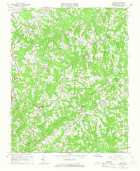
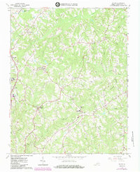
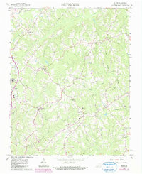
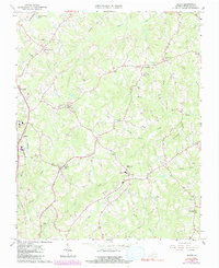
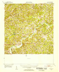
1964 Map of Blairs
USGS Topo · Published 1966About this map
Blairs and Keeling serve as the primary hubs in this mid-1960s snapshot of Pittsylvania County, where the landscape is defined by the winding Dan River and its numerous tributaries like Sandy Creek and Birch Creek. The map documents a community deeply rooted in its local institutions, from the Faith Home for Children to several rural educational centers including Southside High Sch and Kentuck High Sch. Transportation and utility infrastructure are clearly marked, featuring the Southern railroad line running through the western corridor and a prominent Pipeline cutting across the terrain.
Find a feature on this map
37 named features on this map. Tap any name to fly to it.
Don’t see what you’re looking for? This feature index may not catch every label — zoom into the map to look around manually.
Map Details
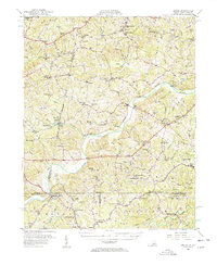
Editions of this 1964 Blairs Map
4 editions found
Other maps of this area

1921 · Chatham
USGS Topo · 1:48,000

1923 · Danville
USGS Topo · 1:48,000

1923 · Chatham
USGS Topo · 1:62,500

1925 · Danville
USGS Topo · 1:62,500
1952 · Milton
USGS Topo · 1:62,500

1953 · Greensboro
USGS Topo · 1:250,000

1954 · Greensboro
USGS Topo · 1:250,000

1954 · Riceville
USGS Topo · 1:62,500
1956 · Milton
USGS Topo · 1:62,500

1962 · Greensboro
USGS Topo · 1:250,000