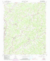
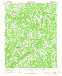
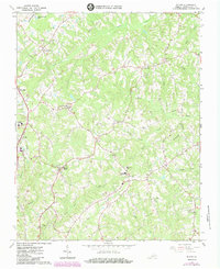
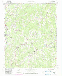
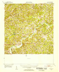
1964 Map of Blairs
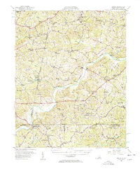
USGS Topo · Published 1991About this map
Blairs and the surrounding tobacco country of Pittsylvania County are defined by a dense network of creek branches and small agricultural settlements as they appeared in the early 1960s. The Southern railroad line anchors the western edge of the map, supporting the local economy near Southside High Sch and the community of Malmaison. A significant corridor of activity follows Kentucky Road toward the community of Kentucky, where Dan River High Sch stands.
Find a feature on this map
36 named features on this map. Tap any name to fly to it.
Don’t see what you’re looking for? This feature index may not catch every label — zoom into the map to look around manually.
Map Details
Editions of this 1964 Blairs Map
4 editions found
Other maps of this area

1921 · Chatham
USGS Topo · 1:48,000

1923 · Danville
USGS Topo · 1:48,000

1923 · Chatham
USGS Topo · 1:62,500

1925 · Danville
USGS Topo · 1:62,500
1952 · Milton
USGS Topo · 1:62,500

1953 · Greensboro
USGS Topo · 1:250,000

1954 · Greensboro
USGS Topo · 1:250,000

1954 · Riceville
USGS Topo · 1:62,500
1956 · Milton
USGS Topo · 1:62,500

1962 · Greensboro
USGS Topo · 1:250,000