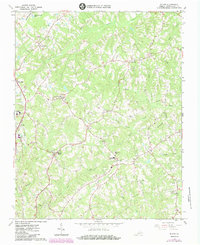
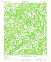
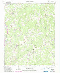
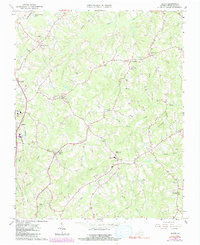
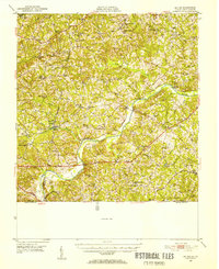
1964 Map of Blairs
USGS Topo · Published 1984About this map
Blairs and the surrounding Pittsylvania County countryside are defined by a complex network of creeks and small family-centric settlements in the early 1960s. The Southern railroad line runs through the western portion of the sheet, anchoring the community of Blairs, while the rural landscape to the east is dotted with country churches such as Oak Grove Ch and Malmaison Ch. This map reveals a community in transition, showing the expansion of education with Southside High Sch and Dan River High Sch, alongside traditional agricultural landmarks like Chestnut Level and Keeling. Waterways like Sandy Creek and Birch Creek dictate the local topography, carving through the terrain where small family cemeteries and local landmarks like the Radio Tower are preserved in the survey record. A noted Pipeline cutting across the landscape highlights the infrastructure supporting this region of Virginia during the mid-twentieth century.
Find a feature on this map
38 named features on this map. Tap any name to fly to it.
Don’t see what you’re looking for? This feature index may not catch every label — zoom into the map to look around manually.
Map Details
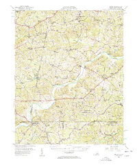
Editions of this 1964 Blairs Map
4 editions found
Other maps of this area

1921 · Chatham
USGS Topo · 1:48,000

1923 · Danville
USGS Topo · 1:48,000

1923 · Chatham
USGS Topo · 1:62,500

1925 · Danville
USGS Topo · 1:62,500
1952 · Milton
USGS Topo · 1:62,500

1953 · Greensboro
USGS Topo · 1:250,000

1954 · Greensboro
USGS Topo · 1:250,000

1954 · Riceville
USGS Topo · 1:62,500
1956 · Milton
USGS Topo · 1:62,500

1962 · Greensboro
USGS Topo · 1:250,000