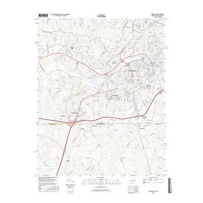
2016 Map of Danville
USGS Topo · Published 2016About this map
The Dan River flows through the center of this 2016 survey, defining the industrial and civic heart of Danville and its surrounding neighborhoods. Spanning the water are several key crossings including the Union Street Bridge, Worsham Street Bridge, and Robertson Bridge, connecting the main city center to northern districts like Westover Hills and Dundee. The urban landscape is densely packed with sites of local historical and genealogical significance, particularly its numerous burial grounds such as Leemont Cem, Grove Street Cem, and the Freedmens Cem.
Find a feature on this map
154 named features on this map. Tap any name to fly to it.
Don’t see what you’re looking for? This feature index may not catch every label — zoom into the map to look around manually.
Map Details
Editions of this 2016 Danville Map
This is the sole edition of this map. No revisions or reprints were ever made.
Other maps of this area

1923 · Danville
USGS Topo · 1:48,000

1924 · Draper
USGS Topo · 1:48,000

1925 · Danville
USGS Topo · 1:62,500

1926 · Draper
USGS Topo · 1:62,500

1944 · Draper
USGS Topo · 1:62,500

1953 · Greensboro
USGS Topo · 1:250,000

1954 · Greensboro
USGS Topo · 1:250,000

1962 · Greensboro
USGS Topo · 1:250,000

1964 · Mount Hermon
USGS Topo · 1:24,000
1964 · Blairs
USGS Topo · 1:24,000