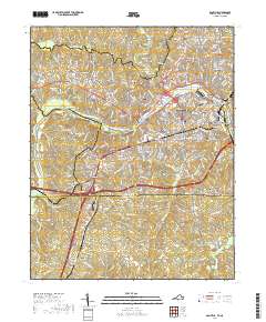
2019 Map of Danville
USGS Topo · Published 2019About this map
The Dan River flows through the heart of the city of Danville, serving as the central geographic feature for this late 2010s survey. The map records the contemporary footprint of major local institutions, including Averett University and its North Campus, as well as Danville Community College. Several historical neighborhoods and mill-town areas such as Schoolfield and Almagro are clearly delineated, alongside more modern residential expansions like Westover Hills.
Find a feature on this map
58 named features on this map. Tap any name to fly to it.
Don’t see what you’re looking for? This feature index may not catch every label — zoom into the map to look around manually.
Map Details
Editions of this 2019 Danville Map
This is the sole edition of this map. No revisions or reprints were ever made.
Other maps of this area

1923 · Danville
USGS Topo · 1:48,000

1924 · Draper
USGS Topo · 1:48,000

1925 · Danville
USGS Topo · 1:62,500

1926 · Draper
USGS Topo · 1:62,500

1944 · Draper
USGS Topo · 1:62,500

1953 · Greensboro
USGS Topo · 1:250,000

1954 · Greensboro
USGS Topo · 1:250,000

1962 · Greensboro
USGS Topo · 1:250,000

1964 · Mount Hermon
USGS Topo · 1:24,000
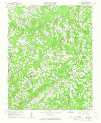
1964 · Blairs
USGS Topo · 1:24,000