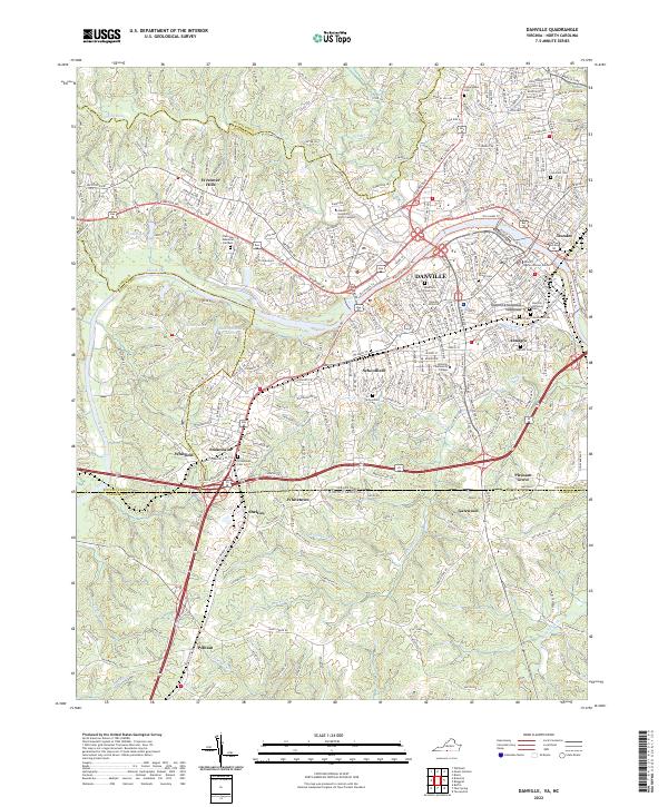
2022 Map of Danville
USGS Topo · Published 2022About this map
The Danville city center and its industrial suburbs dominate this 2022 survey, showcasing the urban layout along the Dan River. The map meticulously identifies numerous historic burial grounds, including the Danville National Cem and the Freedmens Cem near Almagro, which provide significant data points for genealogists and local historians. To the west, the former mill town of Schoolfield and the rail-oriented neighborhood of Stokesland illustrate the geographic expansion of the area beyond the traditional core. Higher education is a visible anchor of the community, represented by Averett University and its North Campus, alongside the Danville Community College. The landscape is also defined by recreational development like the Riverwalk Trl, which follows the riverbank past Dundee and into the heart of the city, transitioning into the Future Riverwalk Trl in newer development zones.
Find a feature on this map
47 named features on this map. Tap any name to fly to it.
Don’t see what you’re looking for? This feature index may not catch every label — zoom into the map to look around manually.
Map Details
Editions of this 2022 Danville Map
This is the sole edition of this map. No revisions or reprints were ever made.
Other maps of this area

1923 · Danville
USGS Topo · 1:48,000

1924 · Draper
USGS Topo · 1:48,000

1925 · Danville
USGS Topo · 1:62,500

1926 · Draper
USGS Topo · 1:62,500

1944 · Draper
USGS Topo · 1:62,500

1953 · Greensboro
USGS Topo · 1:250,000

1954 · Greensboro
USGS Topo · 1:250,000

1962 · Greensboro
USGS Topo · 1:250,000

1964 · Mount Hermon
USGS Topo · 1:24,000
1964 · Blairs
USGS Topo · 1:24,000