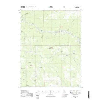
2018 Map of Dardanelle
USGS Topo · Published 2018About this map
The Middle Fork Stanislaus River carves a deep path through this high-elevation landscape of Stanislaus National Forest, defining the settlement patterns of the early 21st century. Small outposts and camping flats like Dardanelle, Wagner, and Brightman Flat cling to the river corridor, which serves as the primary route through this complex terrain of granite peaks and glacial meadows. Geologic landmarks are prominent, including the distinctive Columns of the Giants and The Three Chimneys, while the presence of the Silver Mine near Lower Relief Valley points to the area's prospecting history.
Find a feature on this map
45 named features on this map. Tap any name to fly to it.
Don’t see what you’re looking for? This feature index may not catch every label — zoom into the map to look around manually.
Map Details
Editions of this 2018 Dardanelle Map
This is the sole edition of this map. No revisions or reprints were ever made.
Other maps of this area

1896 · Dardanelles
USGS Topo · 1:125,000

1898 · Dardanelles
USGS Topo · 1:125,000

1948 · Walker Lake
USGS Topo · 1:250,000

1956 · Dardanelles Cone
USGS Topo · 1:62,500

1956 · Pinecrest
USGS Topo · 1:62,500

1956 · Sonora Pass
USGS Topo · 1:62,500
1956 · Tower Peak
USGS Topo · 1:62,500

1957 · Walker Lake
USGS Topo · 1:250,000

1962 · Walker Lake
USGS Topo · 1:250,000

1964 · Walker Lake
USGS Topo · 1:250,000