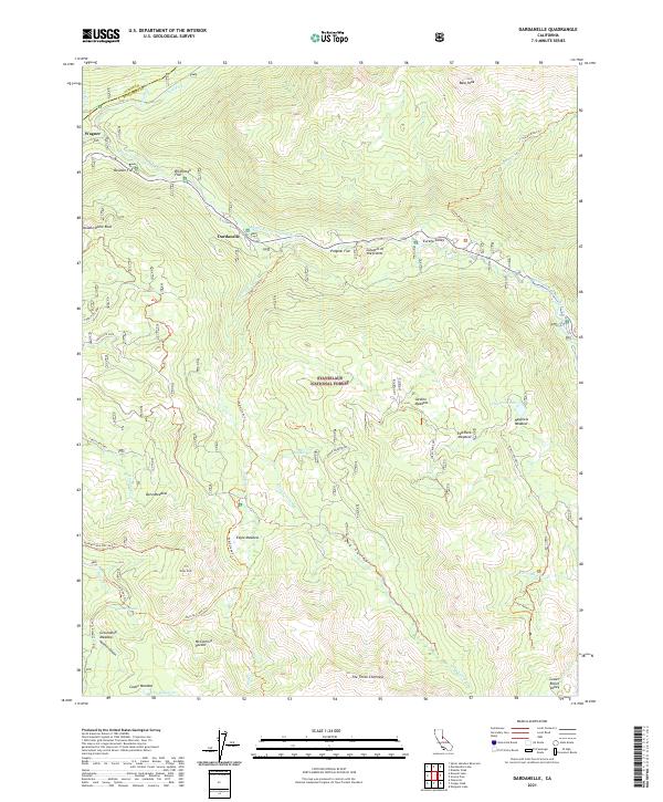
2021 Map of Dardanelle
USGS Topo · Published 2021About this map
Dardanelle and Wagner serve as the primary human touchpoints in this high-elevation landscape of the Stanislaus National Forest. The geography is defined by the Middle Fork Stanislaus River and its numerous tributaries, including Clark Fork and Eagle Creek, which have carved deep valleys and created the broad, flat basins that support extensive meadow systems. These meadows, such as Barn Meadow, Eagle Meadow, and Sardine Meadow, represent essential grazing and ecological hubs within the wilderness. A network of historical trails and forest routes, including the Seven Pines Trl and Eagle Creek Trl, provides access to distinctive geological landmarks like the Columns of the Giants and The Three Chimneys. The map captures the complex terrain at the boundary of Tuolumne and Alpine counties, where peaks like Bald Peak overlook the deep recesses of Hammill Canyon and McCormick Pocket.
Find a feature on this map
49 named features on this map. Tap any name to fly to it.
Don’t see what you’re looking for? This feature index may not catch every label — zoom into the map to look around manually.
Map Details
Editions of this 2021 Dardanelle Map
This is the sole edition of this map. No revisions or reprints were ever made.
Other maps of this area

1896 · Dardanelles
USGS Topo · 1:125,000

1898 · Dardanelles
USGS Topo · 1:125,000

1948 · Walker Lake
USGS Topo · 1:250,000

1956 · Dardanelles Cone
USGS Topo · 1:62,500

1956 · Pinecrest
USGS Topo · 1:62,500

1956 · Sonora Pass
USGS Topo · 1:62,500
1956 · Tower Peak
USGS Topo · 1:62,500

1957 · Walker Lake
USGS Topo · 1:250,000

1962 · Walker Lake
USGS Topo · 1:250,000

1964 · Walker Lake
USGS Topo · 1:250,000