
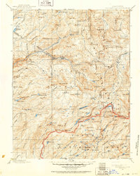
1896 Map of Dardanelles
USGS Topo · Published 1896About this map
The High Sierra landscape is dominated by the intersecting watersheds of the North Fork Stanislaus River and the Middle Fork Stanislaus River. This late-nineteenth-century survey documents a transition in land management, showing the early boundaries of the Stanislaus Forest Reserve and the northern reaches of Yosemite National Park. Human presence is sparse, centered around established outposts like Baker Station, Brightman Flat, and Niagara, which served as critical landmarks for travelers navigating the passes between the central valley and the Great Basin.
Find a feature on this map
150 named features on this map. Tap any name to fly to it.
Don’t see what you’re looking for? This feature index may not catch every label — zoom into the map to look around manually.
Map Details
Editions of this 1896 Dardanelles Map
2 editions found
Other maps of this area

1889 · Pyramid Peak
USGS Topo · 1:125,000

1889 · Markleeville
USGS Topo · 1:125,000

1891 · Markleeville
USGS Topo · 1:125,000

1891 · Big Trees
USGS Topo · 1:125,000

1891 · Pyramid Peak
USGS Topo · 1:125,000

1891 · Wellington
USGS Topo · 1:125,000

1893 · Markleeville
USGS Topo · 1:125,000

1893 · Sonora
USGS Topo · 1:125,000

1893 · Wellington
USGS Topo · 1:125,000

1894 · Big Trees
USGS Topo · 1:125,000