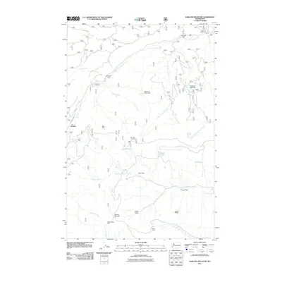
2011 Map of Darland Mountain
USGS Topo · Published 2011About this map
Darland Mountain stands as a central topographic anchor in this 2011 survey of Yakima County, where the high-altitude landscape transitions between dramatic ridges and high mountain meadows. The terrain is defined by its water system, with the South Fork Tieton River and North Fork Ahtanum Creek draining complex slopes marked by features like Blue Slide and Dead Hole. Human presence in this wilderness is primarily reflected through seasonal land use, including the Grey Creek Campground and the Blue Slide Lookout Tower, a site of critical importance for forest surveillance.
Find a feature on this map
35 named features on this map. Tap any name to fly to it.
Don’t see what you’re looking for? This feature index may not catch every label — zoom into the map to look around manually.
Map Details
Editions of this 2011 Darland Mountain Map
This is the sole edition of this map. No revisions or reprints were ever made.
Other maps of this area

1902 · Mount Aix
USGS Topo · 1:125,000

1904 · Mt Aix
USGS Topo · 1:125,000

1904 · Mount Adams
USGS Topo · 1:125,000

1907 · Mount Adams
USGS Topo · 1:125,000

1950 · Yakima
USGS Topo · 1:250,000

1958 · Yakima
USGS Topo · 1:250,000

1961 · Yakima
USGS Topo · 1:250,000

1962 · White Pass
USGS Topo · 1:62,500

1967 · Rimrock Lake
USGS Topo · 1:24,000

1967 · Tieton Basin
USGS Topo · 1:24,000