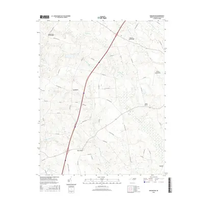
2016 Map of Darlington
USGS Topo · Published 2016About this map
Darlington and Allen Grove anchor this portion of the Coastal Plain, where a intricate network of wetlands and drainage basins defines the landscape. The region is heavily marked by the presence of large swamp systems, including Marsh Swamp to the north and the extensive Burnt Coat Swamp and Beaverdam Swamp to the southwest. These low-lying areas dictate the positioning of rural crossroads such as Andersons Crossroads and Pierces Crossroads, which serve as small nodes in a landscape of dispersed farms and timber tracts.
Find a feature on this map
52 named features on this map. Tap any name to fly to it.
Don’t see what you’re looking for? This feature index may not catch every label — zoom into the map to look around manually.
Map Details
Editions of this 2016 Darlington Map
This is the sole edition of this map. No revisions or reprints were ever made.
Other maps of this area

1953 · Norfolk
USGS Topo · 1:250,000

1960 · Dawson Crossroads
USGS Topo · 1:24,000

1961 · Enfield
USGS Topo · 1:24,000

1963 · Ringwood
USGS Topo · 1:24,000

1973 · Aurelian Springs
USGS Topo · 1:24,000
1973 · Thelma
USGS Topo · 1:24,000

1974 · Halifax
USGS Topo · 1:24,000
1974 · Roanoke Rapids
USGS Topo · 1:24,000
1974 · Weldon
USGS Topo · 1:24,000

1974 · Darlington
USGS Topo · 1:24,000