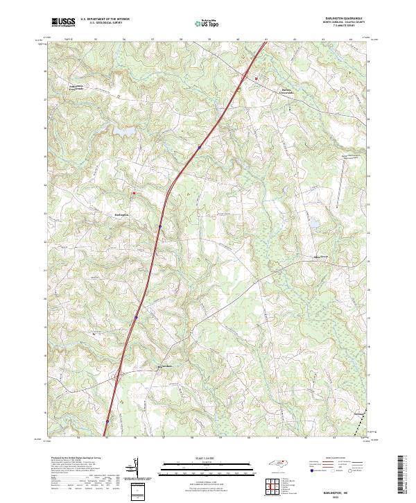
2022 Map of Darlington
USGS Topo · Published 2022About this map
Darlington and its surrounding rural hamlets define this corner of Halifax County, characterized by a complex network of wetlands and drainage creeks. The landscape is heavily influenced by large lowland systems such as Marsh Swamp, Martin Swamp, and Burnt Coat Swamp, which dictate the placement of roads and small settlements. The area shows a transition from traditional crossroads like Andersons Crossroads and Pierces Crossroads to modern transportation infrastructure, with a major interstate corridor bisecting the central terrain.
Find a feature on this map
53 named features on this map. Tap any name to fly to it.
Don’t see what you’re looking for? This feature index may not catch every label — zoom into the map to look around manually.
Map Details
Editions of this 2022 Darlington Map
This is the sole edition of this map. No revisions or reprints were ever made.
Other maps of this area

1953 · Norfolk
USGS Topo · 1:250,000

1960 · Dawson Crossroads
USGS Topo · 1:24,000

1961 · Enfield
USGS Topo · 1:24,000

1963 · Ringwood
USGS Topo · 1:24,000

1973 · Aurelian Springs
USGS Topo · 1:24,000
1973 · Thelma
USGS Topo · 1:24,000

1974 · Halifax
USGS Topo · 1:24,000
1974 · Roanoke Rapids
USGS Topo · 1:24,000
1974 · Weldon
USGS Topo · 1:24,000

1974 · Darlington
USGS Topo · 1:24,000