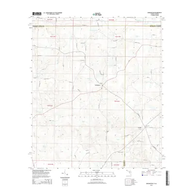
2015 Map of Darlington
USGS Topo · Published 2015About this map
The Pea River flows across the northern edge of this landscape where the Florida-Alabama state line meets at the intersection of Walton, Holmes, and Geneva counties. Settlement is concentrated around the crossroads of Darlington and Leonia, connected by a network of rural roads such as SR-2 and CR-181. The topography is defined by numerous water features, including the Hurricane Cr drainage system and isolated water bodies like Burgess Pond and Miller Pond.
Find a feature on this map
75 named features on this map. Tap any name to fly to it.
Don’t see what you’re looking for? This feature index may not catch every label — zoom into the map to look around manually.
Map Details
Editions of this 2015 Darlington Map
This is the sole edition of this map. No revisions or reprints were ever made.
Other maps of this area

1942 · Enterprise
USGS Topo · 1:125,000

1949 · Glendale
USGS Topo · 1:62,500

1949 · Hobbs Crossroads
USGS Topo · 1:24,000

1950 · Hobbs Cross Roads
USGS Topo · 1:24,000

1950 · Prosperity
USGS Topo · 1:24,000

1951 · Glendale
USGS Topo · 1:62,500

1953 · Andalusia
USGS Topo · 1:250,000

1953 · Dothan
USGS Topo · 1:250,000

1954 · Dothan
USGS Topo · 1:250,000

1954 · Tallahassee
USGS Topo · 1:250,000