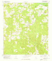
1973 Map of Darlington
USGS Topo · Published 1975About this map
Darlington stands at the center of this rural landscape in the 1970s, where Walton County, Florida, meets the Alabama state line. The area is defined by a network of drainage ways and swampy basins known locally as bays, including Dukes Bay, Porter Bay, and Pikehole Bay. Settlement patterns are anchored by small community churches and cemeteries that serve as vital links for family historians, such as Oak Grove Ch and the nearby Oak Grove Cem.
Find a feature on this map
37 named features on this map. Tap any name to fly to it.
Don’t see what you’re looking for? This feature index may not catch every label — zoom into the map to look around manually.
Map Details
Editions of this 1973 Darlington Map
2 editions found
Other maps of this area

1942 · Enterprise
USGS Topo · 1:125,000

1949 · Glendale
USGS Topo · 1:62,500

1949 · Hobbs Crossroads
USGS Topo · 1:24,000

1950 · Hobbs Cross Roads
USGS Topo · 1:24,000

1950 · Prosperity
USGS Topo · 1:24,000

1951 · Glendale
USGS Topo · 1:62,500

1953 · Andalusia
USGS Topo · 1:250,000

1953 · Dothan
USGS Topo · 1:250,000

1954 · Dothan
USGS Topo · 1:250,000

1954 · Tallahassee
USGS Topo · 1:250,000