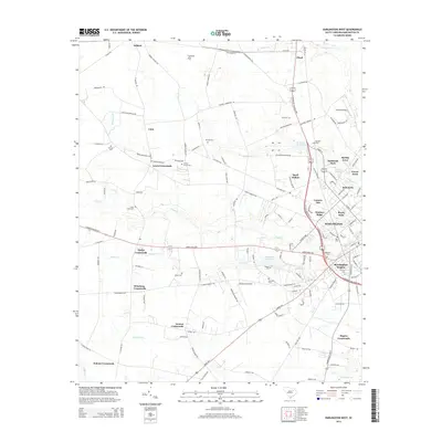
2014 Map of Darlington West
USGS Topo · Published 2014About this map
Darlington is anchored in the southeast corner of this survey, surrounded by a transition from suburban residential developments to traditional agricultural crossroads. Numerous subdivisions such as Brockington Heights, Royal Oaks, and Hunters Ridge indicate the expansion of the city footprint, while the surrounding countryside maintains its historical identity through family-named landmarks and rural hubs like Earlys Crossroads, Wineberg Crossroads, and Iseman Crossroads. The landscape is defined by the drainage of Swift Cr and Indian Cr, which were once utilized for industry as evidenced by McGowns Millpond and Ramseys Millpond. Genealogists will find a significant distribution of burial sites across the landscape, including Flowers Cem, Cherry Grove Cem, and Magnolia Cem, providing a clear record of local family lineages and rural church communities throughout the Darlington area.
Find a feature on this map
143 named features on this map. Tap any name to fly to it.
Don’t see what you’re looking for? This feature index may not catch every label — zoom into the map to look around manually.
Map Details
Editions of this 2014 Darlington West Map
This is the sole edition of this map. No revisions or reprints were ever made.
Other maps of this area

1940 · Florence West
USGS Topo · 1:62,500

1941 · Spartanburg
USGS Topo · 1:250,000

1945 · Florence West
USGS Topo · 1:62,500

1953 · Florence
USGS Topo · 1:250,000

1953 · Spartanburg
USGS Topo · 1:250,000

1954 · Florence
USGS Topo · 1:250,000

1960 · Spartanburg
USGS Topo · 1:250,000

1963 · Spartanburg
USGS Topo · 1:250,000

1963 · Dovesville
USGS Topo · 1:24,000

1963 · Mont Clare
USGS Topo · 1:24,000