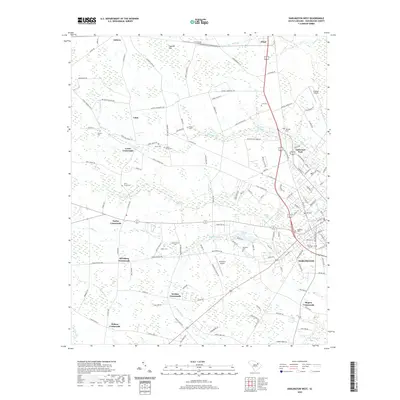
2020 Map of Darlington West
USGS Topo · Published 2020About this map
Darlington serves as the focal point of this South Carolina landscape, where the town's western reaches meet a network of rural crossroads and family settlements. The geography is defined by the winding paths of Swift Creek and Indian Creek, which drain the lowlands between named junctions such as Wineberg Crossroads and Earlys Crossroads. These crossroads often served as vital community hubs before modern highway expansion, frequently anchored by small family cemeteries or local industries near water sources like McCowns Millpond.
Find a feature on this map
131 named features on this map. Tap any name to fly to it.
Don’t see what you’re looking for? This feature index may not catch every label — zoom into the map to look around manually.
Map Details
Editions of this 2020 Darlington West Map
This is the sole edition of this map. No revisions or reprints were ever made.
Other maps of this area

1940 · Florence West
USGS Topo · 1:62,500

1941 · Spartanburg
USGS Topo · 1:250,000

1945 · Florence West
USGS Topo · 1:62,500

1953 · Florence
USGS Topo · 1:250,000

1953 · Spartanburg
USGS Topo · 1:250,000

1954 · Florence
USGS Topo · 1:250,000

1960 · Spartanburg
USGS Topo · 1:250,000

1963 · Spartanburg
USGS Topo · 1:250,000

1963 · Dovesville
USGS Topo · 1:24,000

1963 · Mont Clare
USGS Topo · 1:24,000