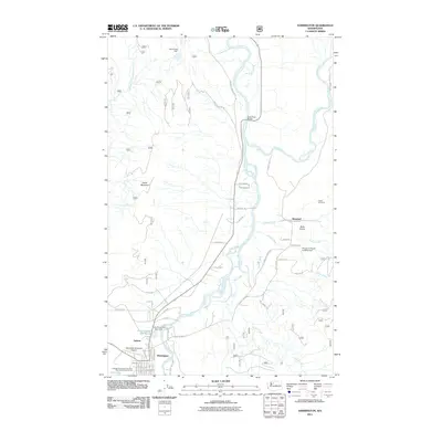
2011 Map of Darrington
USGS Topo · Published 2011About this map
Darrington serves as the focal point of this 2011 survey, situated at the junction of the Sauk River and the North-Fork-Stillaguamish River. The town’s layout is clearly defined by its street grid, including Commercial Ave and Railroad Ave, reflecting its history as a center for timber and transport. To the north, the industrial footprint of the Three Rivers Mill and the Three Rivers Mill Pond Dam marks the edge of the settlement near Andron.
Find a feature on this map
69 named features on this map. Tap any name to fly to it.
Don’t see what you’re looking for? This feature index may not catch every label — zoom into the map to look around manually.
Map Details
Editions of this 2011 Darrington Map
This is the sole edition of this map. No revisions or reprints were ever made.
Other maps of this area

1899 · Glacier Peak
USGS Topo · 1:125,000

1899 · Stillaguamish
USGS Topo · 1:125,000

1901 · Glacier Peak
USGS Topo · 1:125,000

1901 · Stilaguamish
USGS Topo · 1:125,000

1955 · Concrete
USGS Topo · 1:250,000

1957 · Silverton
USGS Topo · 1:62,500

1958 · Concrete
USGS Topo · 1:250,000

1962 · Concrete
USGS Topo · 1:250,000
1966 · Darrington
USGS Topo · 1:24,000
1966 · White Chuck Mtn.
USGS Topo · 1:24,000