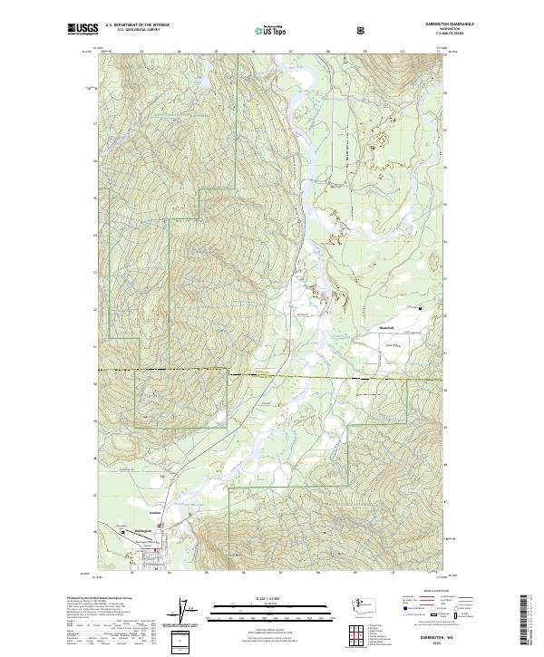
2023 Map of Darrington
USGS Topo · Published 2023About this map
The junction of the North Fork Stillaguamish River and the Sauk River forms the backbone of this mountain valley landscape, situated within the Mount Baker National Forest. The town of Darrington serves as the primary hub, showing a grid of streets like Cascade St and Main St alongside the Darrington Municipal Airport. Smaller settlements such as Mansford and Andron are located to the north and east, connected by the winding S Concrete Sauk Valley Rd.
Find a feature on this map
44 named features on this map. Tap any name to fly to it.
Don’t see what you’re looking for? This feature index may not catch every label — zoom into the map to look around manually.
Map Details
Editions of this 2023 Darrington Map
This is the sole edition of this map. No revisions or reprints were ever made.
Other maps of this area

1899 · Glacier Peak
USGS Topo · 1:125,000

1899 · Stillaguamish
USGS Topo · 1:125,000

1901 · Glacier Peak
USGS Topo · 1:125,000

1901 · Stilaguamish
USGS Topo · 1:125,000

1955 · Concrete
USGS Topo · 1:250,000

1957 · Silverton
USGS Topo · 1:62,500

1958 · Concrete
USGS Topo · 1:250,000

1962 · Concrete
USGS Topo · 1:250,000
1966 · Darrington
USGS Topo · 1:24,000
1966 · White Chuck Mtn.
USGS Topo · 1:24,000