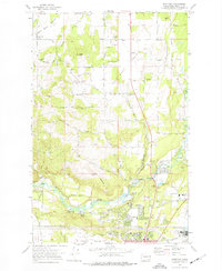
1973 Map of Dartford
USGS Topo · Published 1977About this map
The Little Spokane River winds through the southern reaches of this landscape, anchoring a valley that transitions from agricultural flats into suburban growth. During the early 1970s, the area south of the Spokane corporate boundary shows the expansion of residential clusters like Brentwood and Waikiki, alongside institutional landmarks such as Whitworth College. The northern half of the map is defined by the broad expanse of Wild Rose Prairie and Half Moon Prairie, where the terrain is punctuated by significant rises like Pease Hill and McKay Hill.
Find a feature on this map
73 named features on this map. Tap any name to fly to it.
Don’t see what you’re looking for? This feature index may not catch every label — zoom into the map to look around manually.
Map Details
Editions of this 1973 Dartford Map
2 editions found
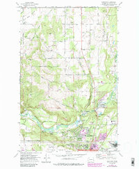
Other maps of this area

1901 · Spokane
USGS Topo · 1:125,000

1943 · Medical Lake
USGS Topo · 1:62,500

1944 · Clayton
USGS Topo · 1:62,500

1949 · Deer Park
USGS Topo · 1:62,500

1950 · Spokane NE
USGS Topo · 1:24,000

1950 · Spokane NW
USGS Topo · 1:24,000

1950 · Spokane
USGS Topo · 1:62,500

1950 · Clayton
USGS Topo · 1:62,500

1951 · Deer Park
USGS Topo · 1:62,500

1954 · Airway Heights
USGS Topo · 1:24,000