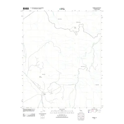
2012 Map of Darwin
USGS Topo · Published 2012About this map
Darwin is the primary settlement on this Inyo County survey, positioned south of the Darwin Hills and near the intersection of the Olancha Darwin Rd and Zinc Mill Rd. The landscape is dominated by complex arid topography, ranging from the Darwin Plateau in the north to the Argus Range in the southeast. Water sources are critical landmarks in this environment, including Darwin Falls, China Garden Spring, and Millers Spring, which appear as small oases amidst the network of seasonal drainages like Santa Rosa Wash and Darwin Wash. The presence of Ophir Mountain and the high elevation of the Father Crowley Viewpoint overlooking Rainbow Canyon indicate a region shaped by extreme relief and sparse desert habitation, where industrial names like Zinc Mill Rd hint at the area's mining history.
Find a feature on this map
18 named features on this map. Tap any name to fly to it.
Don’t see what you’re looking for? This feature index may not catch every label — zoom into the map to look around manually.
Map Details
Editions of this 2012 Darwin Map
This is the sole edition of this map. No revisions or reprints were ever made.
Other maps of this area

1908 · Ballarat
USGS Topo · 1:250,000

1913 · Ballarat
USGS Topo · 1:250,000

1948 · Death Valley
USGS Topo · 1:250,000

1950 · Darwin
USGS Topo · 1:62,500

1951 · Darwin
USGS Topo · 1:62,500

1951 · Panamint Butte
USGS Topo · 1:62,500

1951 · Maturango Peak
USGS Topo · 1:62,500

1951 · Coso Peak
USGS Topo · 1:62,500

1954 · Death Valley
USGS Topo · 1:250,000

1956 · Death Valley
USGS Topo · 1:250,000