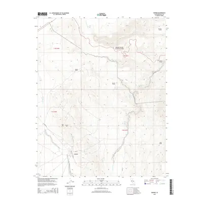
2015 Map of Darwin
USGS Topo · Published 2015About this map
Darwin sits at the base of the Darwin Hills in Inyo County, anchoring a high desert landscape where the Mojave Desert meets the eastern Sierra rain shadow. The town's grid, defined by N Main St and E Market St, serves as a gateway to the arid peaks of Ophir Mtn and the neighboring Argus Range. To the northeast, the terrain drops dramatically toward Death Valley National Park, revealing the geological complexity of the Darwin Plateau and the deep incision of Rainbow Canyon. Water is the defining scarcity here, marked by isolated points like Millers Spring and China Garden Spring, while drainage patterns are etched into the earth by Lucky Jim Wash and the Santa Rosa Wash. This 2015 survey details the modern layout of the settlement against its historic mining and desert-crossing backdrop, including the route of the Old Toll Rd through Darwin Canyon.
Find a feature on this map
24 named features on this map. Tap any name to fly to it.
Don’t see what you’re looking for? This feature index may not catch every label — zoom into the map to look around manually.
Map Details
Editions of this 2015 Darwin Map
This is the sole edition of this map. No revisions or reprints were ever made.
Other maps of this area

1908 · Ballarat
USGS Topo · 1:250,000

1913 · Ballarat
USGS Topo · 1:250,000

1948 · Death Valley
USGS Topo · 1:250,000

1950 · Darwin
USGS Topo · 1:62,500

1951 · Darwin
USGS Topo · 1:62,500

1951 · Panamint Butte
USGS Topo · 1:62,500

1951 · Maturango Peak
USGS Topo · 1:62,500

1951 · Coso Peak
USGS Topo · 1:62,500

1954 · Death Valley
USGS Topo · 1:250,000

1956 · Death Valley
USGS Topo · 1:250,000