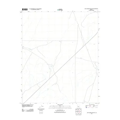
2011 Map of Date Creek Ranch SE
USGS Topo · Published 2011About this map
Bullard Wash cuts through this arid landscape in Maricopa County, defining the drainage patterns of a region where water management is critical to ranching and survival. The map highlights a series of man-made water catchments, including Fogle Tank and T K Tank, which serve as vital infrastructure for local land use. These scattered tanks, such as Little Pemberton Tank and Little Black Hill Tank, illustrate the adaptation of landholders to the desert environment. A primary transportation route bisects the area diagonally, connecting the remote water features and providing the necessary access for maintaining these crucial resource points. The topography is characterized by subtle elevation changes and seasonal washes, with Rincon Tank and Ritter Tank situated at strategic points along the terrain's natural contours.
Find a feature on this map
8 named features on this map. Tap any name to fly to it.
Don’t see what you’re looking for? This feature index may not catch every label — zoom into the map to look around manually.
Map Details
Editions of this 2011 Date Creek Ranch SE Map
This is the sole edition of this map. No revisions or reprints were ever made.
Other maps of this area

1887 · Prescott
USGS Topo · 1:250,000

1892 · Prescott
USGS Topo · 1:250,000

1903 · Congress
USGS Topo · 1:125,000

1904 · Congress
USGS Topo · 1:125,000

1923 · Signal
USGS Topo · 1:250,000

1942 · Signal
USGS Topo · 1:250,000

1942 · Vicksburg
USGS Topo · 1:250,000

1950 · Prescott
USGS Topo · 1:250,000

1954 · Prescott
USGS Topo · 1:250,000

1954 · Phoenix
USGS Topo · 1:250,000