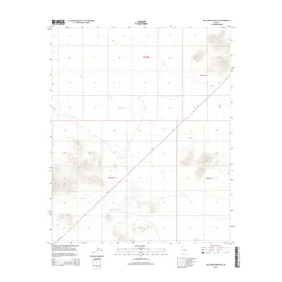
2014 Map of Date Creek Ranch SE
USGS Topo · Published 2014About this map
Bullard Wash cuts a prominent path across this desert landscape in western Arizona, serving as the primary drainage through a terrain marked by isolated peaks and seasonal water catchments. The distribution of infrastructure here revolves around water management, with numerous cattle tanks such as TK Tank, Wood Tank, and Ritter Tank strategically placed to support ranching operations in this arid environment. The presence of Little Pemberton Tank and Little Black Hill Tank further emphasizes the necessity of these reliable water points for local land use. Transport in the region is defined by the diagonal corridor of Az-71, providing the sole modern thoroughfare across the townships. This 2014 survey documents the continued reliance on traditional water-harvesting features within the vast sections of the Sonoran desert during the early twenty-first century.
Find a feature on this map
13 named features on this map. Tap any name to fly to it.
Don’t see what you’re looking for? This feature index may not catch every label — zoom into the map to look around manually.
Map Details
Editions of this 2014 Date Creek Ranch SE Map
This is the sole edition of this map. No revisions or reprints were ever made.
Other maps of this area

1887 · Prescott
USGS Topo · 1:250,000

1892 · Prescott
USGS Topo · 1:250,000

1903 · Congress
USGS Topo · 1:125,000

1904 · Congress
USGS Topo · 1:125,000

1923 · Signal
USGS Topo · 1:250,000

1942 · Signal
USGS Topo · 1:250,000

1942 · Vicksburg
USGS Topo · 1:250,000

1950 · Prescott
USGS Topo · 1:250,000

1954 · Prescott
USGS Topo · 1:250,000

1954 · Phoenix
USGS Topo · 1:250,000