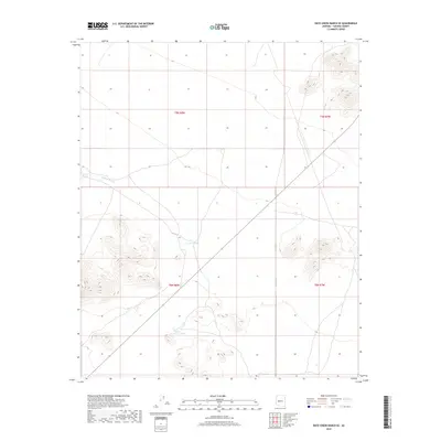
2018 Map of Date Creek Ranch SE
USGS Topo · Published 2018About this map
Bullard Wash defines the drainage patterns of this high desert terrain in Yavapai County, where water management is the primary marker of human presence on the land. The landscape is dotted with essential water sources like Little Pimberton Tank, Wood Tank, and Fogle Tank, which provide crucial points of reference for ranching operations in this arid environment. The map shows a region organized by the Public Land Survey System, specifically within the boundaries of t9n r8w, t9n r7w, t8n r8w, and t8n r7w. These survey lines and scattered water tanks illustrate how the sparse western interior was partitioned and utilized for grazing during the early twenty-first century.
Find a feature on this map
8 named features on this map. Tap any name to fly to it.
Don’t see what you’re looking for? This feature index may not catch every label — zoom into the map to look around manually.
Map Details
Editions of this 2018 Date Creek Ranch SE Map
This is the sole edition of this map. No revisions or reprints were ever made.
Other maps of this area

1887 · Prescott
USGS Topo · 1:250,000

1892 · Prescott
USGS Topo · 1:250,000

1903 · Congress
USGS Topo · 1:125,000

1904 · Congress
USGS Topo · 1:125,000

1923 · Signal
USGS Topo · 1:250,000

1942 · Signal
USGS Topo · 1:250,000

1942 · Vicksburg
USGS Topo · 1:250,000

1950 · Prescott
USGS Topo · 1:250,000

1954 · Prescott
USGS Topo · 1:250,000

1954 · Phoenix
USGS Topo · 1:250,000