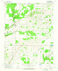
1964 Map of Datto
USGS Topo · Published 1965About this map
The Little Black River winds along the western edge of this 1964 survey, defining a landscape where the river's natural course meets an increasingly organized system of drainage infrastructure. This delta-fringe territory is crisscrossed by man-made channels like Cypress Ditch, Indian Creek, and Townsend Ditch, reflecting the mid-century agricultural transformation of the Arkansas-Missouri border. The St Louis-San Francisco railroad serves as the primary spine for the small settlements of Success and Datto, which anchor the rural community alongside numerous family-named cemeteries and churches.
Find a feature on this map
35 named features on this map. Tap any name to fly to it.
Don’t see what you’re looking for? This feature index may not catch every label — zoom into the map to look around manually.
Map Details
Editions of this 1964 Datto Map
2 editions found
Other maps of this area

1935 · Acorn
USGS Topo · 1:62,500

1935 · Knobel
USGS Topo · 1:62,500

1935 · Reyno
USGS Topo · 1:62,500

1939 · Doniphan
USGS Topo · 1:62,500

1940 · Naylor
USGS Topo · 1:62,500

1941 · Knobel
USGS Topo · 1:62,500

1944 · Naylor
USGS Topo · 1:62,500

1945 · Doniphan
USGS Topo · 1:62,500

1957 · Poplar Bluff
USGS Topo · 1:250,000

1959 · Poplar Bluff
USGS Topo · 1:250,000