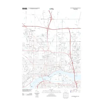
2013 Map of Davenport East
USGS Topo · Published 2013About this map
The Mississippi River defines the southern edge of this Quad Cities landscape, separating Rock Island from the expanding urban neighborhoods of eastern Davenport. Three major crossings dominate the riverfront, including the historic Government Bridge, Centennial Bridge, and the Memorial Bridge. Further inland, the city's residential growth is evidenced by established subdivisions like Ridgeview Park, Green Acres, and the neighborhood of Antoine LeClair, while the northern portion of the map remains more open with the Davenport Municipal Airport and the community of Mount Joy.
Find a feature on this map
304 named features on this map. Tap any name to fly to it.
Don’t see what you’re looking for? This feature index may not catch every label — zoom into the map to look around manually.
Map Details
Editions of this 2013 Davenport East Map
This is the sole edition of this map. No revisions or reprints were ever made.
Other maps of this area

1891 · Davenport
USGS Topo · 1:62,500

1892 · Leclaire
USGS Topo · 1:62,500

1893 · Leclaire
USGS Topo · 1:62,500

1894 · Davenport
USGS Topo · 1:62,500

1899 · Clinton
USGS Topo · 1:125,000

1901 · Rock Island
USGS Topo · 1:125,000

1910 · Rock Island
USGS Topo · 1:125,000

1912 · Milan
USGS Topo · 1:62,500

1937 · Orion
USGS Topo · 1:62,500

1944 · Milan
USGS Topo · 1:62,500