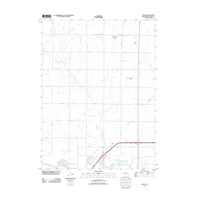
2011 Map of Davey
USGS Topo · Published 2011About this map
Little Salt Creek meanders through the heart of this landscape just north of Lincoln, where the transition from rural agricultural land to suburban expansion is clearly visible. The small settlement of Davey remains a focal point in the northern portion of the quadrangle, anchored by the Davey Post Office and a network of gravel and paved roads like Davey Rd and Branched Oak Rd. To the south, the community of Arbor sits near the intersection of major thoroughfares, reflecting the development patterns of the early 21st century.
Find a feature on this map
42 named features on this map. Tap any name to fly to it.
Don’t see what you’re looking for? This feature index may not catch every label — zoom into the map to look around manually.
Map Details
Editions of this 2011 Davey Map
This is the sole edition of this map. No revisions or reprints were ever made.
Other maps of this area

1897 · Lincoln
USGS Topo · 1:125,000

1899 · Wahoo
USGS Topo · 1:125,000

1955 · Fremont
USGS Topo · 1:250,000

1955 · Lincoln
USGS Topo · 1:250,000

1957 · Fremont
USGS Topo · 1:250,000

1957 · Lincoln
USGS Topo · 1:250,000

1958 · Fremont
USGS Topo · 1:250,000

1958 · Lincoln
USGS Topo · 1:250,000

1964 · Waverly
USGS Topo · 1:24,000

1964 · Davey
USGS Topo · 1:24,000