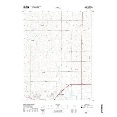
2017 Map of Davey
USGS Topo · Published 2017About this map
Lincoln and its northern outskirts define this 2017 landscape in Lancaster County, showing the suburban expansion into formerly rural sections. The northern village of Davey remains distinct, situated near the headwaters of Ash Hollow Cr and Jordan Cr. This survey illustrates the transition from the city's residential developments, such as those along Blue Sage Blvd and Aster Rd, to the grid-patterned agricultural lands to the north. Local history is anchored by the Danish Cem and Tothill Cem, both situated along the rolling terrain between the major tributaries. The hydrology of the area is dominated by the winding course of Little Salt Cr and the broader valley of Salt Creek in the southeast, which influenced the early placement of roads like Branched Oak Rd and Waverly Rd.
Find a feature on this map
38 named features on this map. Tap any name to fly to it.
Don’t see what you’re looking for? This feature index may not catch every label — zoom into the map to look around manually.
Map Details
Editions of this 2017 Davey Map
This is the sole edition of this map. No revisions or reprints were ever made.
Other maps of this area

1897 · Lincoln
USGS Topo · 1:125,000

1899 · Wahoo
USGS Topo · 1:125,000

1955 · Fremont
USGS Topo · 1:250,000

1955 · Lincoln
USGS Topo · 1:250,000

1957 · Fremont
USGS Topo · 1:250,000

1957 · Lincoln
USGS Topo · 1:250,000

1958 · Fremont
USGS Topo · 1:250,000

1958 · Lincoln
USGS Topo · 1:250,000

1964 · Waverly
USGS Topo · 1:24,000

1964 · Davey
USGS Topo · 1:24,000