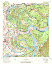
1965 Map of Davis Island
USGS Topo · Published 1971About this map
The dramatic meanders of the Mississippi River dominate this mid-century landscape, carving out a complex geography of cutoffs, chutes, and points along the Louisiana-Mississippi border. A powerful reminder of the river's history is the Winter Quarters Crevasse May 4, 1927, marking the site of a breach from the Great Mississippi Flood. The town of Newellton and the surrounding plantations are protected by levees and flood gates, while the river's old path is traced by oxbows like Lake St Joseph, Lake Bruin, and Palmyra Lake.
Find a feature on this map
107 named features on this map. Tap any name to fly to it.
Don’t see what you’re looking for? This feature index may not catch every label — zoom into the map to look around manually.
Map Details
Editions of this 1965 Davis Island Map
3 editions found
Other maps of this area

1909 · Delta Bridge
USGS Topo · 1:24,000

1909 · Lake Bruen
USGS Topo · 1:24,000

1909 · Mound
USGS Topo · 1:24,000

1910 · Mound
USGS Topo · 1:31,680

1918 · Vicksburg
USGS Topo · 1:62,500

1935 · Waverly
USGS Topo · 1:62,500

1935 · Shackleford Lake
USGS Topo · 1:62,500

1939 · Talla Bena
USGS Topo · 1:62,500

1939 · Yokena
USGS Topo · 1:62,500

1939 · Lorman
USGS Topo · 1:62,500