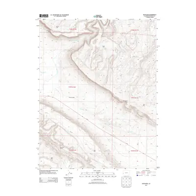
2013 Map of Davis Mesa
USGS Topo · Published 2013About this map
Paradox Valley defines the central geography of this Western Colorado landscape, where the transverse drainage of the Dolores River cuts across the valley floor. The terrain is characterized by dramatic elevation shifts between high plateaus and deep incisions, notably seen at Carpenter Ridge and Martin Mesa. Water sources in this arid environment are sparse, marked by the presence of Stone Spring and seasonal drainages like W Paradox Cr and E Paradox Cr.
Find a feature on this map
27 named features on this map. Tap any name to fly to it.
Don’t see what you’re looking for? This feature index may not catch every label — zoom into the map to look around manually.
Map Details
Editions of this 2013 Davis Mesa Map
This is the sole edition of this map. No revisions or reprints were ever made.
Other maps of this area

1916 · Paradox Valley
USGS Topo · 1:125,000

1922 · Paradox Valley
USGS Topo · 1:125,000

1948 · Roc Creek
USGS Topo · 1:24,000

1948 · Bull Canyon
USGS Topo · 1:24,000

1948 · Uravan
USGS Topo · 1:24,000

1948 · Naturita NW
USGS Topo · 1:24,000

1948 · Paradox
USGS Topo · 1:24,000

1949 · Bull Canyon
USGS Topo · 1:24,000

1949 · Davis Mesa
USGS Topo · 1:24,000

1949 · Uravan
USGS Topo · 1:24,000