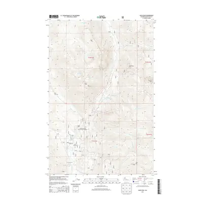
2014 Map of Davis Peak
USGS Topo · Published 2014About this map
Davis Peak Lookout and Jolly Mountain Lookout stand as prominent survey points above the high country of the Wenatchee National Forest. This 2014 survey documents a landscape defined by the confluence of numerous glacial drainages, most notably where the Cle Elum River meets Salmon la Sac Cr and the Cooper River. The recreational development of the era is evident in the cluster of organized sites near Salmon la Sac, including Salmon la Sac Campground and Cayuse Campground. High-elevation water bodies like Michael Lake, Moonshine Lake, and Lake Terence are scattered across the alpine basins. The map also records the network of forest roads and trails that provide access to remote features such as China Point and the slopes of Goat Mtn.
Find a feature on this map
37 named features on this map. Tap any name to fly to it.
Don’t see what you’re looking for? This feature index may not catch every label — zoom into the map to look around manually.
Map Details
Editions of this 2014 Davis Peak Map
This is the sole edition of this map. No revisions or reprints were ever made.
Other maps of this area

1897 · Mount Stuart
USGS Topo · 1:125,000

1901 · Chiwaukum
USGS Topo · 1:125,000

1901 · Snoqualmie Pass
USGS Topo · 1:125,000

1902 · Skykomish
USGS Topo · 1:125,000

1902 · Mount Stuart
USGS Topo · 1:125,000

1903 · Snoqualmie
USGS Topo · 1:125,000

1904 · Chiwaukum
USGS Topo · 1:125,000

1905 · Skykomish
USGS Topo · 1:125,000

1957 · Wenatchee
USGS Topo · 1:250,000

1961 · Mount Stuart
USGS Topo · 1:62,500