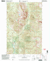
2003 Map of Davis Peak
USGS Topo · Published 2006About this map
Salmon La Sac sits at the convergence of mountain waters and forest management in this early 21st-century record of the Cascades. The map details the local infrastructure supporting this seasonal outpost, including the Salmon La Sac Guard Station, a Sewage Disposal Pond, and a Water Treatment Plant. The landscape is dominated by high peaks such as Goat Mountain and Davis Peak, which define the topography between the Cle Elum River and the Waptus River.
Find a feature on this map
34 named features on this map. Tap any name to fly to it.
Don’t see what you’re looking for? This feature index may not catch every label — zoom into the map to look around manually.
Map Details
Editions of this 2003 Davis Peak Map
This is the sole edition of this map. No revisions or reprints were ever made.
Other maps of this area

1897 · Mount Stuart
USGS Topo · 1:125,000

1901 · Chiwaukum
USGS Topo · 1:125,000

1901 · Snoqualmie Pass
USGS Topo · 1:125,000

1902 · Skykomish
USGS Topo · 1:125,000

1902 · Mount Stuart
USGS Topo · 1:125,000

1903 · Snoqualmie
USGS Topo · 1:125,000

1904 · Chiwaukum
USGS Topo · 1:125,000

1905 · Skykomish
USGS Topo · 1:125,000

1957 · Wenatchee
USGS Topo · 1:250,000

1961 · Mount Stuart
USGS Topo · 1:62,500