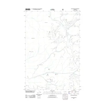
2011 Map of Davis Point
USGS Topo · Published 2011About this map
Waldbilling Mine and the Berry Rush Mine sit high above the drainage of Miller Creek, illustrating the deep-seated mineral extraction history of this part of Missoula County. The terrain is defined by prominent elevations such as Davis Point and Baldy Mountain, which divide a complex network of watercourses including Spooner Creek and Holloman Creek. In the southern portion of the sheet, the focus shifts toward the Eightmile Creek corridor, where more extensive mining operations like the Eight Mile Creek Placer Mine and the White Cloud Mine are located. The presence of the Woodchuck Dam on Woodchuck Creek indicates localized water management for the region's industrial or agricultural needs. Roads with names like Quartz Ridge Rd and Sapphire Ridge Rd further reinforce the geological and prospecting character of the landscape.
Find a feature on this map
40 named features on this map. Tap any name to fly to it.
Don’t see what you’re looking for? This feature index may not catch every label — zoom into the map to look around manually.
Map Details
Editions of this 2011 Davis Point Map
This is the sole edition of this map. No revisions or reprints were ever made.
Other maps of this area

1903 · Bonner
USGS Topo · 1:125,000

1912 · Missoula
USGS Topo · 1:125,000

1947 · Butte
USGS Topo · 1:250,000

1956 · Hamilton
USGS Topo · 1:250,000

1958 · Butte
USGS Topo · 1:250,000

1959 · Hamilton
USGS Topo · 1:250,000

1959 · Cleveland Mountain
USGS Topo · 1:62,500

1960 · Butte
USGS Topo · 1:250,000

1960 · Hamilton
USGS Topo · 1:250,000

1962 · Butte
USGS Topo · 1:250,000