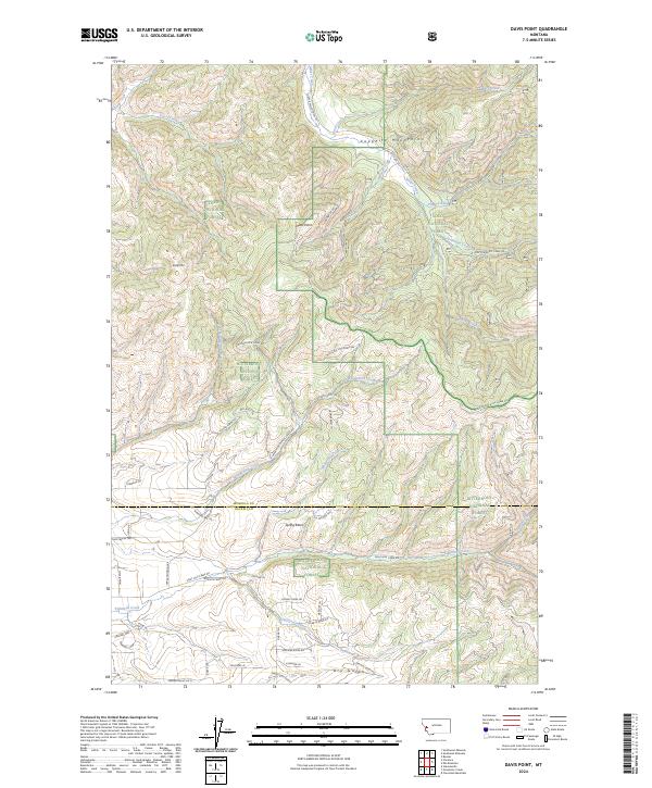
2024 Map of Davis Point
USGS Topo · Published 2024About this map
The Sapphire Mountains dominate this landscape along the border of Missoula and Ravalli counties, where the high-altitude terrain is managed between the Lolo National Forest and Bitterroot National Forest. Peaks like Baldy Mtn and Davis Point overlook a complex network of drainage basins and forest service roads. The southern portion of the map transition into the Eightmile Creek drainage, featuring numerous named gulches such as Dry Gulch and Sandstone Gulch. Modern residential developments are evident in the southwest corner with named streets like Windmill Loop and Heavens Way, contrasting with the more primitive tracks like Copper Ridge Trl and Red Rock Trl that penetrate the steeper slopes. This map provides a clear picture of how contemporary access roads and trails interface with the traditional timber and watershed lands of the northern Rockies.
Find a feature on this map
63 named features on this map. Tap any name to fly to it.
Don’t see what you’re looking for? This feature index may not catch every label — zoom into the map to look around manually.
Map Details
Editions of this 2024 Davis Point Map
This is the sole edition of this map. No revisions or reprints were ever made.
Other maps of this area

1903 · Bonner
USGS Topo · 1:125,000

1912 · Missoula
USGS Topo · 1:125,000

1947 · Butte
USGS Topo · 1:250,000

1956 · Hamilton
USGS Topo · 1:250,000

1958 · Butte
USGS Topo · 1:250,000

1959 · Hamilton
USGS Topo · 1:250,000

1959 · Cleveland Mountain
USGS Topo · 1:62,500

1960 · Butte
USGS Topo · 1:250,000

1960 · Hamilton
USGS Topo · 1:250,000

1962 · Butte
USGS Topo · 1:250,000