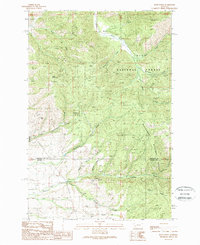
1989 Map of Davis Point
USGS Topo · Published 1989About this map
Baldy Mountain and the high ridge of Davis Point dominate this 1989 topographic study of the forested borderlands between Missoula and Ravalli Counties. This transition zone is defined by the meeting of two major timber reserves, the Lolo National Forest and the Bitterroot National Forest. The landscape is etched by a dense network of drainage systems, including Miller Creek, Eightmile Creek, and Sluice Creek, which carve deep into the rugged terrain south of the Missoula valley.
Find a feature on this map
21 named features on this map. Tap any name to fly to it.
Don’t see what you’re looking for? This feature index may not catch every label — zoom into the map to look around manually.
Map Details
Editions of this 1989 Davis Point Map
This is the sole edition of this map. No revisions or reprints were ever made.
Other maps of this area

1903 · Bonner
USGS Topo · 1:125,000

1912 · Missoula
USGS Topo · 1:125,000

1947 · Butte
USGS Topo · 1:250,000

1956 · Hamilton
USGS Topo · 1:250,000

1958 · Butte
USGS Topo · 1:250,000

1959 · Hamilton
USGS Topo · 1:250,000

1959 · Cleveland Mountain
USGS Topo · 1:62,500

1960 · Butte
USGS Topo · 1:250,000

1960 · Hamilton
USGS Topo · 1:250,000

1962 · Butte
USGS Topo · 1:250,000