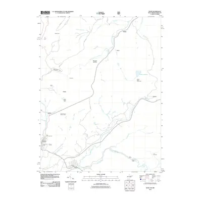
2011 Map of Davis
USGS Topo · Published 2011About this map
Hoye-Crest and Chestnut Ridge Run define the high terrain of this borderland where Maryland and West Virginia meet. The North Branch Potomac River snakes through the northern reaches of the quadrangle, passing through the settlements of Dobbin and Henry. Further south, the landscape shifts toward the drainage of the Blackwater River, which feeds into the Canaan Valley. This transition between major river systems is marked by historical infrastructure, including the City of Thomas Dam and the Elk Run Reservoir, which highlight the area's developed water resources.
Find a feature on this map
46 named features on this map. Tap any name to fly to it.
Don’t see what you’re looking for? This feature index may not catch every label — zoom into the map to look around manually.
Map Details
Editions of this 2011 Davis Map
This is the sole edition of this map. No revisions or reprints were ever made.
Other maps of this area

1886 · St. George
USGS Topo · 1:125,000

1891 · St. George
USGS Topo · 1:125,000

1895 · Piedmont
USGS Topo · 1:125,000

1899 · Oakland
USGS Topo · 1:62,500

1900 · Oakland
USGS Topo · 1:62,500

1907 · Kingwood
USGS Topo · 1:62,500

1908 · Parsons
USGS Topo · 1:62,500

1916 · Davis
USGS Topo · 1:48,000

1918 · Davis
USGS Topo · 1:62,500

1919 · Davis
USGS Topo · 1:62,500