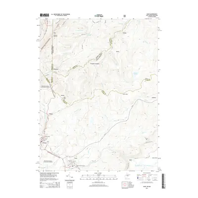
2014 Map of Davis
USGS Topo · Published 2014About this map
Backbone Mountain defines the high elevation terrain along the border of Maryland and West Virginia, where the North Branch Potomac River begins its course. This area is shaped by a history of industrial rail and mining activity, evidenced by the clustered settlements of Thomas and Davis in the south, and the coal-related landscape around Kempton and Kempton Junction to the north. The survey details the high-altitude topography of the Monongahela National Forest, showing the transition from the ridges of Hoye-Crest down to the headwaters of the Blackwater River. Researchers can trace the layout of mountain towns including William, Gatzmer, and Henry, alongside water features like Elk Run Reservoir and the expansive Canaan Valley. The inclusion of the Thomas Cem and the Thomas Patrick Memorial Bridge provides specific points of interest for genealogists and local historians tracking family landmarks in the Potomac highlands.
Find a feature on this map
74 named features on this map. Tap any name to fly to it.
Don’t see what you’re looking for? This feature index may not catch every label — zoom into the map to look around manually.
Map Details
Editions of this 2014 Davis Map
This is the sole edition of this map. No revisions or reprints were ever made.
Other maps of this area

1886 · St. George
USGS Topo · 1:125,000

1891 · St. George
USGS Topo · 1:125,000

1895 · Piedmont
USGS Topo · 1:125,000

1899 · Oakland
USGS Topo · 1:62,500

1900 · Oakland
USGS Topo · 1:62,500

1907 · Kingwood
USGS Topo · 1:62,500

1908 · Parsons
USGS Topo · 1:62,500

1916 · Davis
USGS Topo · 1:48,000

1918 · Davis
USGS Topo · 1:62,500

1919 · Davis
USGS Topo · 1:62,500