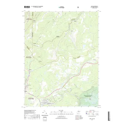
2019 Map of Davis
USGS Topo · Published 2019About this map
Davis and Thomas serve as the primary hubs in this high-altitude landscape where the North Branch Potomac River and the Blackwater River begin their respective journeys. The map details a complex intersection of state and county lines, including the historic Fairfax stone area where West Virginia and Maryland meet. This territory is defined by its transition from industrial logging and coal history toward conservation, with large portions of the Monongahela National Forest and the Canaan Valley National Wildlife Refuge protecting the headwaters of the Potomac. Local infrastructure like the Thomas Patrick Memorial Bridge and the Thomas Cem provide touchpoints for local family history, while the trail systems such as the Beaver Creek Trail and Splash Dam 5 Trail trace the paths of former narrow-gauge rail lines and timber operations that once dominated Dobbin Ridge and the surrounding mountains.
Find a feature on this map
86 named features on this map. Tap any name to fly to it.
Don’t see what you’re looking for? This feature index may not catch every label — zoom into the map to look around manually.
Map Details
Editions of this 2019 Davis Map
This is the sole edition of this map. No revisions or reprints were ever made.
Other maps of this area

1886 · St. George
USGS Topo · 1:125,000

1891 · St. George
USGS Topo · 1:125,000

1895 · Piedmont
USGS Topo · 1:125,000

1899 · Oakland
USGS Topo · 1:62,500

1900 · Oakland
USGS Topo · 1:62,500

1907 · Kingwood
USGS Topo · 1:62,500

1908 · Parsons
USGS Topo · 1:62,500

1916 · Davis
USGS Topo · 1:48,000

1918 · Davis
USGS Topo · 1:62,500

1919 · Davis
USGS Topo · 1:62,500