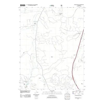
2011 Map of Dawson Butte
USGS Topo · Published 2011About this map
West Plum Creek and East Plum Creek define the drainage of this Douglas County landscape, where the foothills of the Front Range meet expanding residential development. The 2011 survey shows a mix of established ranching history and modern suburban growth, centered around the prominent landform of Dawson Butte. Evidence of earlier industry persists at the Perry Park Mine and the Waucondah Dam near the Waucondah Reservoir in the southwest corner. Local genealogy and history are anchored by the Glen Grove Cemetery, while the small settlement of Tomah sits along the eastern corridor. The map also records specialized land use, such as the Continental Divide Raceway, and newer neighborhoods like Monte Vista Estates, illustrating the transition of the Colorado high country from a mining and agricultural region into a contemporary residential landscape.
Find a feature on this map
56 named features on this map. Tap any name to fly to it.
Don’t see what you’re looking for? This feature index may not catch every label — zoom into the map to look around manually.
Map Details
Editions of this 2011 Dawson Butte Map
This is the sole edition of this map. No revisions or reprints were ever made.
Other maps of this area

1893 · Platte Canyon
USGS Topo · 1:125,000

1894 · Castle Rock
USGS Topo · 1:125,000

1913 · Castle Rock
USGS Topo · 1:125,000

1940 · Castle Rock
USGS Topo · 1:62,500

1945 · Castle Rock
USGS Topo · 1:62,500

1945 · Kassler
USGS Topo · 1:24,000

1948 · Kassler
USGS Topo · 1:24,000

1953 · Denver
USGS Topo · 1:250,000

1954 · Devils Head
USGS Topo · 1:24,000
1954 · Greenland
USGS Topo · 1:24,000