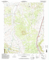
1994 Map of Dawson Butte
USGS Topo · Published 1998About this map
Dawson Butte and Castle Mesa anchor this landscape south of the Castle Rock Corporate Boundary, where the Colorado Front Range transitions from open ranching to emerging residential enclaves. In the early 1990s, this area maintained its rural heritage through sites like Glen Grove Cemetery and the St Phillip in the Field Church, while newer developments like Monte Vista Estates and Perry Park Ranch began to define the local geography. The transportation network is dominated by the parallel routes of The Atchison Topeka and Santa Fe RR and the Denver and Rio Grande Western RR following the eastern valley.
Find a feature on this map
40 named features on this map. Tap any name to fly to it.
Don’t see what you’re looking for? This feature index may not catch every label — zoom into the map to look around manually.
Map Details
Editions of this 1994 Dawson Butte Map
This is the sole edition of this map. No revisions or reprints were ever made.
Other maps of this area

1893 · Platte Canyon
USGS Topo · 1:125,000

1894 · Castle Rock
USGS Topo · 1:125,000

1913 · Castle Rock
USGS Topo · 1:125,000

1940 · Castle Rock
USGS Topo · 1:62,500

1945 · Castle Rock
USGS Topo · 1:62,500

1945 · Kassler
USGS Topo · 1:24,000

1948 · Kassler
USGS Topo · 1:24,000

1953 · Denver
USGS Topo · 1:250,000

1954 · Devils Head
USGS Topo · 1:24,000
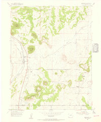
1954 · Greenland
USGS Topo · 1:24,000