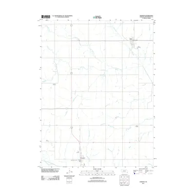
2011 Map of Dawson
USGS Topo · Published 2011About this map
Stella and Dawson anchor this rural Richardson County landscape, where the agricultural grid is defined by a dense network of tributaries feeding into the North Fork Big Nemaha River. The area is characterized by numerous family and community burial grounds, providing a significant resource for genealogical research. Prominent sites include Mound Cemetery, Stratton Cemetery, and Starr Cemetery, which are distributed across the drainage basins of Little Muddy Creek and Whisky Run.
Find a feature on this map
32 named features on this map. Tap any name to fly to it.
Don’t see what you’re looking for? This feature index may not catch every label — zoom into the map to look around manually.
Map Details
Editions of this 2011 Dawson Map
This is the sole edition of this map. No revisions or reprints were ever made.
Other maps of this area

1915 · Falls City
USGS Topo · 1:62,500

1915 · Nemaha
USGS Topo · 1:62,500

1915 · Howe
USGS Topo · 1:62,500

1916 · Humboldt
USGS Topo · 1:62,500

1939 · Nemaha
USGS Topo · 1:62,500

1949 · Nemaha
USGS Topo · 1:62,500

1955 · Nebraska City
USGS Topo · 1:250,000

1957 · Nebraska City
USGS Topo · 1:250,000

1958 · Nebraska City
USGS Topo · 1:250,000
1965 · Salem
USGS Topo · 1:24,000