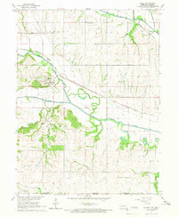
1965 Map of Salem
USGS Topo · Published 1966About this map
Salem serves as the focal point of this mid-1960s survey, situated where the North Fork and South Fork converge to form the Big Nemaha River. The landscape is defined by the sinuous path of the river and its Old Channel, reflecting a valley shaped by significant hydrological activity. To the north, Straussville sits along the Pacific railroad line near Muddy Creek, while the Chicago Burlington and Quincy railroad tracks cut across the northwestern quadrant through Salem. Local community life is anchored by landmarks like St Marks Ch, Maple Cem, and rural education centers such as Five Point Sch. The presence of several quarries and gravel pits near the river forks indicates the importance of local material extraction during this period.
Find a feature on this map
31 named features on this map. Tap any name to fly to it.
Don’t see what you’re looking for? This feature index may not catch every label — zoom into the map to look around manually.
Map Details
Editions of this 1965 Salem Map
This is the sole edition of this map. No revisions or reprints were ever made.
Other maps of this area

1888 · Hiawatha
USGS Topo · 1:125,000

1894 · Hiawatha
USGS Topo · 1:125,000

1915 · Falls City
USGS Topo · 1:62,500

1916 · Humboldt
USGS Topo · 1:62,500

1950 · Kansas City
USGS Topo · 1:250,000

1954 · Kansas City
USGS Topo · 1:250,000

1955 · Nebraska City
USGS Topo · 1:250,000

1956 · Kansas City
USGS Topo · 1:250,000

1957 · Nebraska City
USGS Topo · 1:250,000

1958 · Nebraska City
USGS Topo · 1:250,000